 您当前的位置:
施工船舶实时水流要素预报与水下抛石、疏浚工程形成过程动态监测系统线上发布
发布方:国家内河航道整治工程技术研究中心
This is an intelligent software specially developed for improving the construction efficiency and quality of underwater Riprap and Dredging Projection. It is mainly composed of two systems, which are the real-time flow elements forecast subsystem and dynamic monitoring subsystem of engineering structure formation process.
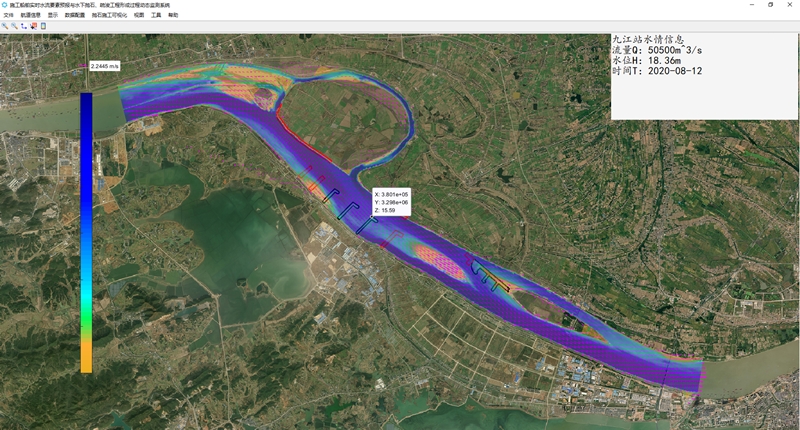
Ⅰ.Real-time flow elements forecasting subsystem
(1) The software has generated a high-definition satellite image scene in construction area, and can display raster and vector data;
(2) Using big data method, the software can automatically obtain the real-time hydrological information and water flow elements of the construction reach;
(3) The software uses GPS serial communication to locate the construction ship in real time;
(4) The software can automatically update the construction progress according to the terrain change of the construction area.
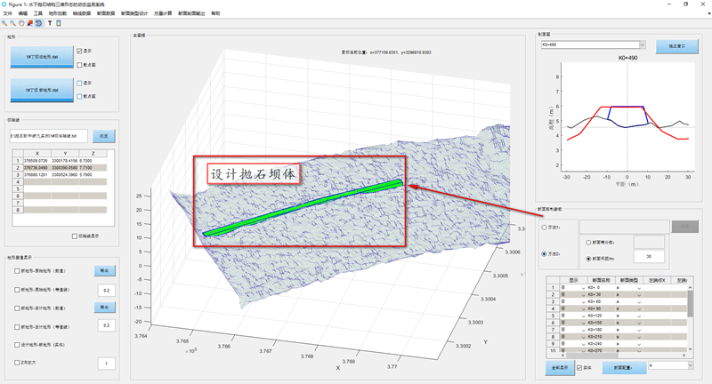
Ⅱ.Dynamic monitoring subsystem of engineering structure formation process
(1) The software can access the terrain data of high-precision multi-wave velocity scanning instrument and display the 3D terrain of the engineering area before and after construction.
(2) The design terrain generation module is set up in the system to quickly generate 3D engineering structure terrain according to 2D riprap and dredging design control section.
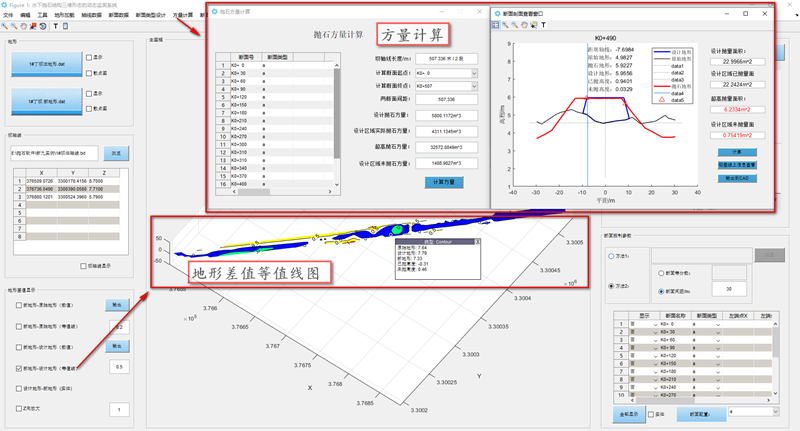
(3) The system set up the section area and volume calculation module to carry out data calculation.
(4) The system set up the terrain-difference calculation module. Through the difference and volume changes between the pre-project terrain, post-project terrain and the design terrain, the comparative analysis and early warning of engineering quality are calculated. In addition, the software can also export the cross-section profile to CAD format.
The software has been well applied in actual engineering and provides good technical support for the quality control of Riprap and Dredging engineering construction.
 渝公网安备 50011202502061号